“Sarah Jane “ is now safely tucked up in her home berth at Mylor.
Since leaving Dartmouth we’ve sailed most of the way with the wind from the south west or west and the tide in our favour, very useful when rounding Start Point and Dodman, although we used the engine little bit between Plymouth and Fowey.
We visited the River Yealm on the way, staying overnight on the visitors pontoon just off Warren Point. We managed to get into the last available space on the river side of the pontoon between two boats, not too difficult, there was no wind and there was a steady flood tide helping us to ferry glide in. Getting off the pontoon was much more difficult the tide was flowing out very fast along the pontoon from our stern, occasionally sweeping on or off the pontoon. There was also a strong wind pushing us onto the pontoon. I was hoping the downstream boat would leave before us but they were staying all day. Having twin rudders, hence no prop wash, doesn’t help in these situations. The only safe was to spring the stern off into the current and go off backwards. Using our big ball fender as a pivot we eventually managed, using full forward power the get the stern round far enough for the tide to overcome the wind and reverse out. We’d enlisted the help of the owner of the powerboat at our stern to make sure our spring line came off ok and also to walk our bow upstream a little way as we came out. He was probably concerned about his boat and more than happy to help. We were a bit concerned that the wind may blow us against the stern of the power boat and were ready to fend off but in the end this wasn’t needed. Boats on mooring buoys were swinging across the tide quite close to the pontoon adding to the fun, guides do warn that this may make turning for large boats difficult, no mention of smaller ones. At times like this we wish we had a bow thruster, quiet or noisy.
Next time we visit we’ll either go to the upper pontoon or pick up a mooring buoy.
“Runcible Moon” our pontoon neighbours in Mylor were on a buoy a little downstream of where we moored. We ate at the Yealm Yacht Club that evening. The clubhouse was very crowded, since it was their regatta the following day, but the food was good. The only black spot, literally, was a plague of flying ants which descended on the area that evening.
We had intended the following day to go up the River Tamar as far as Cargreen. There’s a pub there, The Crooked Spaniard, that Wickersley Joggers visited a couple of years ago during a Cornish weekend. Their mooring buoys are free if a meal is eaten in the pub. However, a couple we met at the Yealm told us the pub has shut down. We tried phoning to confirm this but there was no reply, so we decided not to risk it and go on to Fowey instead.
Fowey was very crowded, we rafted up against a Belgium boat that turned out to be going on the Mylor. We ate at the Gallants Yacht Club where there is a Thai cook with a very good reputation amongst visiting yachtspeople. We ate spring rolls, calamari and Thai style Fowey Mussels. Very good, the cook’s reputation nwas definitely intact. Once a week , Friday we think,they have a Thai tasting evening.
As we were getting out of the dinghy at the town quay a drunken young lad fell off the pontoon into the river. His mate, who was also drunk, managed to grab him to stop him sinking. We tried to pull the helpless lump out of the water but couldn’t, he was too heavy and the other youth was no use at all. Fortunately the Harbour Master was nearby and between us we managed to pull him out. He stood there swaying and eventually fell again, but this time into their dinghy. In spite of strong advice from the Harbour Master to take the water taxi they insisted on going by dinghy and set off weaving across the river to Polruan, shadowed by the Harbour Master. The same HM came to collect our mooring fees the next morning. The two drunks managed eventually to find Polruan but one went for another swim ( or sink) when getting out of the dinghy,but the water was very shallow.
Next day we set off on the final leg of our holiday, from Fowey to Mylor. We had another good sail, from the mouth of the river Fowey to the Castle buoy off St Mawes then started the engine for the short distance to Mylor.
All that remains of the holiday now is to clean the boat and unload it, especially the wine. We shall be down again in a couple of weeks so will leave some stuff on board.
By the time we get home on Thursday we will have been away for six weeks and travelled 562 miles through the water. Since the tides have been with us much of the time we suspect distance over the ground will be much more.
For the next trip we shall have to see if either of our GPS measure actual distance travelled over the ground rather than planned route miles.
PS. The herbs survived well, except for one coriander, which turned to seed. They all came in useful, especially the Basil.
Thursday 29 July 2010
Wednesday 28 July 2010
Back to England
We stayed in Cherbourg for two days, just long enough to stock up our annual supply of wine from “Wine World” in the local Carrefour supermarche. They delivered it to the boat at the marina. It’s all stowed in the front cabin, the only concern is that we’ll lose speed because the prop will be out of the water. We also bought some wine barrels, not high quality stuff but easy to drink and stow. 
We were glad this didn't raft up to us in Cherbourg. Imagine the crew stomping all over your boat when they went off for a quick pillage.
While at the supermarket we bought a bag of cooked large prawns for lunch, about ½ kilo for €4, which we ate with a mayonnaise and tomato dip. When we were in Jersey we had bought in the fish market several very large scallops ( some about the size of coffee cup saucers), 2 king size prawns and a huge handful of calamari, all for less than £10. We ate these for dinner with rice and a creamy lemon sauce. In England we’re surrounded by water but have great difficulty buying high quality seafood at a reasonable price, even by the coast. Why? I suspect that most of what is caught in the UK goes to France or Spain.

We said our farewells to John and Mary, and crew, in Irish Odyssey who were setting of the Chichester in the morning. They were returning the boat to the UK after keeping it in Brittany for several years.
We left Cherbourg early in the morning to catch the west going tide to Braye, Alderney. There was absolutely no wind so we were forced to motor all the way, but the tide was with us and gradually increased as the journey progressed. Two hours after leaving the pontoon we were again at Cap de la Hague with a 5 ½ knot tide pushing us along. Some care is needed here to make sure the SW stream doesn’t carry you down the coast and South of Alderney, again the vectors on the chart plotter proved useful. We were a little concerned that if the strong tide continued there would be a risk of overshooting Braye harbour , but when we reached the north coast of Alderney the tide slackened to a mere two knots and we entered the harbour without a problem.
In the past it was very difficult to pick out the leading marks and lights for entry into Braye but these have obviously been replaced and are now very visible even in bright daylight.
We use the chart plotter a lot. It’s a very useful tool and makes navigating easy, but like to use it to get us to a point where leading lines or lights can be used for pilotage.
Shortly after we arrived a sea fog descended and we couldn’t see the end of the breakwater from our mooring.
Alderney is not our favourite Channel Island although many people love it. Last year the whole island appeared shut because the daughter of the fish & chip shop owner was getting married. We got the impression everyone in Braye and St. Anne was attending.
This trip Jill had missed a meal at one of her favourite restaurants in Cherbourg because it was shut Monday and we were leaving Tuesday, so I promised to treat her at the above chippy in Braye. We took the water taxi ashore to find it only opened Wed/Thurs/Fri/Sat. By that time most of the shops had shut so it was back to the boat for a healthy meal of sausage with onion gravy and mash.
Next day we were up before dawn for the crossing to Dartmouth, and as soon as there was enough light to see a pot buoy we set off, “following” the very bright leading lights out of the harbour. The distance across was 65 miles, a 13 hour trip and we had worked out that the effect of cross tides over that distance would be less than a mile, in our favour. So after clearing the harbour we set course on a direct bearing to Dartmouth. The forecast was for SW F 3-4 but as we set off in the rain with no wind we were anticipating a miserable crossing. Soon though the rain stopped and as the Sun rose above the horizon we had a late breakfast.
The course set took us at an angle across the Casquets shipping lanes. These have to be crossed at right angles so we changed course and motor sailed at maximum speed to clear them as quickly as we could, keeping a good look out visually and on radar, visibility was very good. In the eastbound lane 7-8 ships passed us a good distance away, as predicted by radar and confirmed visually. Another ship was more of a problem, one minute the radar showed it passing a few hundred feet ahead, the next a few hundred behind and the next straight through us. When viewed through binoculars neither its bearing nor aspect was changing, so we decided to play safe and sailed a reciprocal course for about a mile. When we resumed the original course it passed ahead of us about a mile away so we were probably wise to take evasive action. In the westbound lane 9-10 ships passed us, all at a safe distance. I later estimated the diversion needed to cross the shipping lanes added about 4 miles to the straight line distance, the best part of an hour extra sailing time.
While we were crossing the shipping lanes the wind increased to the forecast force 3 and as soon as we left the lanes we started to sail and stopped the engine. For the next 8 hours we sailed on the same tack, either close hauled or on a close reach, on the same heading all the way to the entrance of the River Dart. This was the longest and best sail of the whole trip.
We had one diversion when the clip on backrest bought in Guernsey popped off into the water. We did a quick about turn and in spite of the choppy seas managed to find it again, but couldn’t fish it out again because there was nothing to hook on to.
About 20 miles from Dartmouth the wind increased to force 4 and above and the autohelm began struggling to keep a course so we reverted to hand steering. Eventually we put a single reef in the sails, from the safety of the cockpit without losing much time. Having reefed the boat sailed much better without any reduction in speed and the autohelm was able to cope again, making the rest of the remainder of the journey easier; it holds a much better course than we can.
This sail was the longest without engine since leaving Falmouth. In previous years when sailing the voltage on the fully charged battery would drop the after about 4 hours, the first indication being the autohelm starting to sail in circles, then even with the Raymarine chartplotter turned off the voltage would drop below 11 volts and the Furuno GPS would switch off, forcing us either to sail without some instruments or run the engine to put some charge in the battery. I fitted a Rutland wind generator last year which helped but didn’t cure the problem. I suspected the battery even though it was checked out and declared healthy. This year I fitted a slightly larger capacity, deep cycle battery. This year with the wind charger and new battery the voltage was still around 12.5 after 8 hours sailing with autohelm, chartplotter and occasional use of the radar.
Much to our surprise when we entered Dartmouth, 13 hours after we left Braye, there was a vacant berth on the inside of the town quay. We were helped to raft up to another boat by two sailors from a beautiful Oyster 82 yacht called “Zig Zag” moored on the outside of the quay.
We were able to walk into town and get the fish and chips we had missed in Braye, just in time they were the last two left and the shop was about to shut.
One more consolation; “Zig Zag” had to leave early the next morning to leave the outer side of the
Tuesday 27 July 2010
The Race to Cherbourg
This part is a bit for sailing folk thinking of going from Guernsey to Cherbourg.
Our passage from Guernsey to Cherbourg would take us through the famous or “infamous” Alderney Race. This notorious stretch of water runs between the island of Alderney and the French coast at Cap de la Hague. Every six hours the tide floods through this narrow stretch of water, the six hours later runs back. Tidal streams can run at up to 9-10 knots with heavy over falls and breaking seas. Since the average small sailing yacht travels at 5-6 knots under the wrong conditions or at the wrong time the race can be difficult or dangerous.
We had decided to leave for Cherbourg on Sunday when the forecast showed the strong winds should have dropped to F3-4 from the W or SW.
Reeds almanac suggests leaving St. Peter Port about 3 hours after HW Dover. This gives an adverse tide for the first 2-3 hours after which it changes to favourable. Leaving St. Peter Port at 0730 when high water Dover was 0431 and keeping up a speed of around 5 knots would mean the tide changing in our favour when we were just a couple of miles SW of Alderney, the tide being with us in “the Race” but by no means at full flow. We would then have a positive tide all the way to Cherbourg; that was the plan. Our enforced stay at least meant we would be leaving at a reasonable time, not the crack of dawn.
We had been to Alderney twice before. The first time we had taken the southern route, following the timings in the pilot books, inside Inner Race Rock, round Blanchard Rock to the East of Alderney then North to pick up the west going back eddy into Braye harbour. This passage went well with no over falls. Last year we decided to take the route north of Alderney through “the Swinge”. This was more interesting. It was close to neaps when tidal steams would be expected to be at their weakest, we arrived not long after the tide had turned to run NE and we had a gentle SW wind pushing us with the current, all ideal conditions?? The actual tide running was much faster than predicted in the atlases reaching 7-8 knots at one point. The chart showed heavy overfalls in the middle of the “Swinge”; we passed this point with little disturbance and were relaxing when we hit the overfalls to the east of the Swinge. They were short and very steep. The wind was light, so we were only doing about 3 knots through the water, about 9-10 SOG. We started the engine to give more control and to speed us through, and passed through them without major concerns.
Andy, who lives in Guernsey, leaves St Peter Port as soon as the marina opens on the rising tide then picks up a N/NE going stream immediately, up the Little Russell, North of Alderney through “ the Swinge” and straight to Cherbourg on one tide.
We decided against this option because we went through “the swinge” last year and we also wanted to fill up with diesel, at £0.48 per litre, in Guernsey before we left. By the time we had left the marina and filled up with fuel another hour could have passed and the race could have been in full flow and the tide may have changed before we reached Cherbourg. So we left the marina at high water Saturday, filled up and moored up on one of the outer, all tide, pontoons just ahead of “Irish Odyssey”.
John and Mary of “Irish Odyssey” were also leaving for Cherbourg at 0730 Sunday so we arranged to keep in radio contact during the journey.
As planned we left at 0730, hoisted both sails (unfurled one) just outside the harbour and set off up the” Little Russel”.

 There were two cruise ships anchored just off St Peter Port, the Balmoral and a massive ship the Princess something. Their tenders were already running some people ashore. Why? I can’t imagine there’s too much to do in St. Peter Port at 0730 Sunday morning; perhaps they were all going to church.
Going up the” Little Russel” the tide, as expected, was running against us at up to 2 knots, but with the engine running and a fresh breeze from the South behind us we were able to make a reasonable speed over the ground. Unexpectedly at the top of the Little Russel we picked up a back eddy going our way which pushed us along witht a good two knots.
After clearing “Platte Boue” we set a course for a waypoint 1nm south of “Race Rock”. With a combination of NE course, tide from the NW and a Southerly breeze we gained another unexpected push from the tide of about 1 knot, it all helps and we were able to turn off the engine and keep up a speed over ground of about 5 knots. Unfortunately the cross current was pushing us towards the French coast where the overfalls are the heaviest. We were hoping the tide would change before the cross track error became too large, but just SW of Alderney we ran upwind for a short while to reduce the error. At the same time it became obvious that the tide was beginning to change and we were able to resume our heading and make the “Race Rock” waypoint. The tide gradually increased and by the time we reached “Race Rock” was giving us an extra 6 knots.
We were surprised just how smooth the passage had been up to and past “Race Rock”. This secure, warm feeling was short lived as we hit the overfalls about a mile NE of the rock and for the next half an hour had a very bumpy ride.

Our next waypoint was just to the NW of Cap de la Hague , but the strong N /NE tidal stream was pushing us off track and to stay on course to the waypoint the nose was pointing SE toward Nez de Joburg . At the same time the wind began to drop as it backed from S to SE. With the boom flopping around we restarted the engine.
One really useful feature of the Raymarine system we have is the display on the chart plotter of boat heading vector and course over ground vector, especially in strong tidal situations such as the above.
With hindsight it was a mistake to try to correct for the current and stay on track. We should just have let the tide push us northwards beyond Cap de la Hague, there were no dangers, until we met the east going stream from the north of Alderney. This would have cleared the overfalls much more quickly.
As we said at the time “there’s no point going through the Alderney Race and having to tell people it was flat”.
We were disappointed once we had rounded Cap de la Hague by the relatively weak east going stream towards Cherbourg, 1-2 knots. When we had sailed from Braye to Cherbourg last year the tide further away from the coast had kept up 5-6 knots for some distance and it was obvious that boats further out were gaining a tidal advantage. Had we let the tide in the race push us north we would probably have joined this stronger stream.
Still we couldn’t complain too much. Since Leaving the Little Russel we had sailed all the way, apart from about ½ hour around Cap de la Hague and had picked up a good push from the tide all the way. The tide was still with us as we entered Cherbourg’s outer harbour past one of the very impressive breakwater forts, seven hours after leaving the pontoon at St Peter Port. The distance on the chart from pontoon to pontoon is 44 miles, we clocked 30 miles through the water.
Having experienced both routes next time we make the trip we’ll probably take Andy’s advice and go through the “Swinge” . The overfalls are much shorter in distance and it should then be a straight run with a good tide all the way to Cherbourg.
Monday 19 July 2010
Back to Guernsey
Because of the “Manche Tour “ race we decided to avoid the French coast for a few days and stay in the Channel Isles. There was the prospect of a storm coming through later in the week so we decided to move on the Guernsey after just a couple of nights in St Helier. We much prefer Guernsey to Jersey, so if we were to have an enforced, extended stay in port we would prefer to be in St Peter Port marina. The only possible problem was on the day we were to sail “the race” would be heading from Carteret to St Peter Port, but, if we set off early, as planned we would arrive well ahead of them, assuming they had a midday start time.
With the wind from the South force 3-4 to start, so we had a good sail, almost running, with a strong helping tide until about 5 miles from St Peter Port when the tide turned to across us and the wind dropped to nearly nothing. So, since we were in no hurry, we “drifted” towards St Peter Port, having lunch on the way and taking a further 3 hours to arrive. Just after leaving Jersey we had been overtaken by several sailing boats hurrying under engine. When finally arrived in Guernsey several were the waiting on an outer pontoon for the marina to open in another three hours. Because of the queuing system we entered before several of them.
With the wind from the South force 3-4 to start, so we had a good sail, almost running, with a strong helping tide until about 5 miles from St Peter Port when the tide turned to across us and the wind dropped to nearly nothing. So, since we were in no hurry, we “drifted” towards St Peter Port, having lunch on the way and taking a further 3 hours to arrive. Just after leaving Jersey we had been overtaken by several sailing boats hurrying under engine. When finally arrived in Guernsey several were the waiting on an outer pontoon for the marina to open in another three hours. Because of the queuing system we entered before several of them.

We arrived in Guernsey on Tuesday intending to stay for a couple of days, but high winds later in the week delayed our departure so we ended up having a very pleasant five d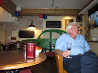 ays in St Peter Port. We met up again with Carolyn and Andy and had dinner in two restaurants, main in one and cheese and puddings in another, the “Petit Bistro”. We had tried to book into the latter for the whole meal, but it was Bastille Day, so was full of celebrating French people. Next time we visit Guernsey it’s a must. The 2CV in nthe background is a real one cut in half.
 ays in St Peter Port. We met up again with Carolyn and Andy and had dinner in two restaurants, main in one and cheese and puddings in another, the “Petit Bistro”. We had tried to book into the latter for the whole meal, but it was Bastille Day, so was full of celebrating French people. Next time we visit Guernsey it’s a must. The 2CV in nthe background is a real one cut in half.
We rafted up against another Falmouth boat, a Westerly called “Golden Eye” owed by George and Rachel Curnow on their back to Cornwall. They were MYC members but now belong to the RCYC.
On Guernsey we always do a fair amount of walking and some cycling, most motorists are very pedestrian and cyclist friendly. We also like the local bus service which seems to serve every little hamlet on the island. Hop on a bus in St Peter Port, get off where you want to start walking and when you’re tired it’s never more than a few hundred yards from a stop, and if the bus comes when you’re between stops stick out a hand and the chances are it stops ( just like England!!).

On Friday Castle Cornet was open for an evening of music and short plays. We were sitting on the boat contemplating whether to go or stay where we were after a longish walk. Fortunately Andy and Carolyn came along and made our minds up for us otherwise we’d have missed a very enjoyable evening. Better still it was free. One of the bands performing was a drum band “Samba Burros” who play a variety of very infectious music. We first came across this type of band at the Cherbourg music festival last year.
Skat the large private yacht we saw in St Malo was in St Peter Port, according to one of the crew they are going to Falmouth. They’re stalking us.
We're off to Cherbourg next.
Sunday 11 July 2010
Eastward to St. Malo and beyond
After a quiet night in St Quay we set of to work our way eastward.
Before leaving we went early morning to the poissonarie and bought a very fresh Ray wing to cook when we arrived.
Again no wind at all when we set off. After leaving St Quay we headed North for a mile or so to clear a rock island running parallel to the coast then headed due East across St Brieuc Bay ( Baie de Saint Brieuc) to cap Frehel. This was slightly longer than the more southern route we had taken westward to St Quay but was a simpler.
In the bay there were large numbers of small fishing boats and a several stern trawlers. The latter are a bit of a nuisance when fishing since they change direction very erratically. Then when the nets are up they set off at high speed to the next fishery. If you’re in the way they head straight towards you and the concern is whether they’ve seen you. Sometimes the skipper can be seen on deck working with the crew sorting the catch, before rushing top the wheelhouse to change course. They also trawl up masses of seaweed which floats to the surface ready to get caught round the rudder or prop. Still, without them you probably wouldn’t be able to buy fresh ray wing early morning.
Just after lunch, off Cap Frehel, the wind sprang up enough for us to sail the rest of the way to Bas Sablons marina just outside St. Malo. We would have no problems entering since it was neaps with a minimum of 2 metres over the cill at any time of the day. Just a couple of short tacks kept us inside the “Chenal de la Grande Porte” then off the wind for an easy run down the “Chenal de la Petite Porte” to St. Malo. We entered “Petit Port” just ahead of a Southerly 38, also sailing. I thought they would overtake us but we gradually pulled away and entered Bas Sablons well ahead. I’m glad we beat him, he docked a couple of boats from us and turned out to be very loud and pompous with an equally loud bow thruster that he appeared to use all the time instead of the rudder.
We ate the ray that night baked in the oven with a gram flour and almond crust, using cooking bags. The fish cooked OK but was difficult to get out of the bag so the crust got a little damaged but tasted OK. We needed fresh cream for the caper sauce, but found it impossible to find in the small local supermarket, so had to use crème fraiche instead, if anything this made the sauce better. The fish was very good, just what you’d expect straight from the quay. Next time we’ll try and stop one of the trawlers as the flash past a few yards away and buy some.
Our plan is to stay three nights in St Malo.
We went to one of our favourite restaurants, in St Servan. Food as good as ever and prices seem lower than last year, someone told us that the tax charged in restaurants has gone down and most have passed this on to customers. Generally though, food and clothes in shops are very expensive.
Since being here we have done a lot of walking, around St Servan and St Malo. We also took the ferry across the river to Dinard. It’s only a small town but it has several miles of very pleasant water front to walk along.
In the basin Vauban in St Malo is moored a very large superyacht named “Skat”, privately owned and registered in the Cayman Islands. According to one of the crew they have no permanent home port but just travel the world and the owner joins them. A very sleek new 60/70 ft powerboat from Guernsey came into Bas Sablons, turned round and went out again, It was called “Envy”. Next day it was moored right behind “Skat” looking very small and insignificant. No matter what boat you have there’s always one bigger.
Before leaving we went early morning to the poissonarie and bought a very fresh Ray wing to cook when we arrived.
Again no wind at all when we set off. After leaving St Quay we headed North for a mile or so to clear a rock island running parallel to the coast then headed due East across St Brieuc Bay ( Baie de Saint Brieuc) to cap Frehel. This was slightly longer than the more southern route we had taken westward to St Quay but was a simpler.
In the bay there were large numbers of small fishing boats and a several stern trawlers. The latter are a bit of a nuisance when fishing since they change direction very erratically. Then when the nets are up they set off at high speed to the next fishery. If you’re in the way they head straight towards you and the concern is whether they’ve seen you. Sometimes the skipper can be seen on deck working with the crew sorting the catch, before rushing top the wheelhouse to change course. They also trawl up masses of seaweed which floats to the surface ready to get caught round the rudder or prop. Still, without them you probably wouldn’t be able to buy fresh ray wing early morning.
Just after lunch, off Cap Frehel, the wind sprang up enough for us to sail the rest of the way to Bas Sablons marina just outside St. Malo. We would have no problems entering since it was neaps with a minimum of 2 metres over the cill at any time of the day. Just a couple of short tacks kept us inside the “Chenal de la Grande Porte” then off the wind for an easy run down the “Chenal de la Petite Porte” to St. Malo. We entered “Petit Port” just ahead of a Southerly 38, also sailing. I thought they would overtake us but we gradually pulled away and entered Bas Sablons well ahead. I’m glad we beat him, he docked a couple of boats from us and turned out to be very loud and pompous with an equally loud bow thruster that he appeared to use all the time instead of the rudder.
We ate the ray that night baked in the oven with a gram flour and almond crust, using cooking bags. The fish cooked OK but was difficult to get out of the bag so the crust got a little damaged but tasted OK. We needed fresh cream for the caper sauce, but found it impossible to find in the small local supermarket, so had to use crème fraiche instead, if anything this made the sauce better. The fish was very good, just what you’d expect straight from the quay. Next time we’ll try and stop one of the trawlers as the flash past a few yards away and buy some.
Our plan is to stay three nights in St Malo.
We went to one of our favourite restaurants, in St Servan. Food as good as ever and prices seem lower than last year, someone told us that the tax charged in restaurants has gone down and most have passed this on to customers. Generally though, food and clothes in shops are very expensive.
Since being here we have done a lot of walking, around St Servan and St Malo. We also took the ferry across the river to Dinard. It’s only a small town but it has several miles of very pleasant water front to walk along.

In the basin Vauban in St Malo is moored a very large superyacht named “Skat”, privately owned and registered in the Cayman Islands. According to one of the crew they have no permanent home port but just travel the world and the owner joins them. A very sleek new 60/70 ft powerboat from Guernsey came into Bas Sablons, turned round and went out again, It was called “Envy”. Next day it was moored right behind “Skat” looking very small and insignificant. No matter what boat you have there’s always one bigger.

From the sea wall at Bas Sablons there is a marvellous view of the Sun setting in the west. We have been to view two nights. The fist night there was a bank of cloud on the horizon but the second night was very clear.
Next stop is Granville just up the coast. Should be “Open All Hours”, but it’s tidal with entry 3 hours either side of high water. We will leave in the morning on the falling tide, as late as we can leave it but still clear the cill, and arrive at Granvlille late afternoon on the next rising tide. By which time there should be plenty of water over the cill there. It’s only 22miles so we should make it comfortably, even allowing for some adverse tidal streams.
Arrived at Granville around 4.00 pm, the entrance had opened at just after 4.00 ( ht of tide at St Malo 6.0m). The visitors pontoons are, surprisingly, fairly empty. We tied up next to “Irish Odyssey” who we’d been next to in Bas Sablons, but had left on Friday. Found out why the place is relatively empty. The “Tour de Ports de Manche” race takes place over the next week or so. The route is: Jersey, Granville, Carteret, Guernsey, Cherbourg and finishes in St Vaast. All the visitors pontoons have been pre-booked by the race organisers until Monday so ALL visitors have to leave in the morning; definitely NOT open all hours. Granville is also expensive at €36 compared to the typical €24 we have been paying. To top it all the electricity went off last night and is still off this morning.
This race has fouled things up because they are due to visit the French ports we want to go to so we will have the same problem elsewhere. We have decided to go back to Jersey, then head to Cherbourg ahead of them.
We left Granville early Sunday morning under a grey sky with a stiff westerly breeze, needing a reef in the sail. Within half an hour the wind had dropped and the reef was taken out. After this we had the first decent sail since leaving Falmouth, with the wind a fairly steady force 3 for most of the trip. The wind dropped to a very gentle breeze about 5 miles from St. Helier, but we were in no hurry to arrive since the marina could not open until late afternoon and were determined to sail all the way, helped by a 2 knot tide all the way
Arrived at Granville around 4.00 pm, the entrance had opened at just after 4.00 ( ht of tide at St Malo 6.0m). The visitors pontoons are, surprisingly, fairly empty. We tied up next to “Irish Odyssey” who we’d been next to in Bas Sablons, but had left on Friday. Found out why the place is relatively empty. The “Tour de Ports de Manche” race takes place over the next week or so. The route is: Jersey, Granville, Carteret, Guernsey, Cherbourg and finishes in St Vaast. All the visitors pontoons have been pre-booked by the race organisers until Monday so ALL visitors have to leave in the morning; definitely NOT open all hours. Granville is also expensive at €36 compared to the typical €24 we have been paying. To top it all the electricity went off last night and is still off this morning.
This race has fouled things up because they are due to visit the French ports we want to go to so we will have the same problem elsewhere. We have decided to go back to Jersey, then head to Cherbourg ahead of them.
We left Granville early Sunday morning under a grey sky with a stiff westerly breeze, needing a reef in the sail. Within half an hour the wind had dropped and the reef was taken out. After this we had the first decent sail since leaving Falmouth, with the wind a fairly steady force 3 for most of the trip. The wind dropped to a very gentle breeze about 5 miles from St. Helier, but we were in no hurry to arrive since the marina could not open until late afternoon and were determined to sail all
 the way, helped by a 2 knot tide all the way
About 3 miles from St Helier we met the “Tour de Ports” fleet just after their start. A single boat, us, on a port tack sailing through 130 racing boats all on starboard was going to be interesting. Fortunately, we were close hauled and they all had spinnakers set and passed down our starboard side apart from a few stragglers at the rear.
We are now in St. Helier marina in almost the same spot we left a couple of weeks ago.
Tuesday 6 July 2010
On to Tréguier
Sunday 4th. July Independence day
As expected the day started sunny and hot, with just enough wind to make manoeuvring in the marina interesting. Picked up fuel then set off, around 10.00am to Tréguier, a trip of about 33miles. Motored on a flat sea for the first 3 hours, then the wind started to increase and we ended up having our first real sail since leaving Falmouth. We even ended up putting one reef in the sails. Not because of safety, but because when the wind reaches about 13/14knots and we are close hauled, reducing sail reduces heel and weather helm ( less rudder drag) and the boat is much quicker.
We had been warned by several people, also in sailing guides, of very strong tidal streams that can run through the marina pontoons at Tréguier, making mooring up tricky. We had expected to arrive at around 3.00pm and to have to stay on the waiting pontoon for the tidal stream to slacken before entering the marina, but, because we sailed we travelled further than expected and arrived just at low water, so went straight into a berth.

Tréguier lies about 6 miles upriver from the sea, the channel is well marked and we managed to sail, apart from the last mile. It is very similar to rivers in Cornwall or Devon even down to the riverside houses and boathouses scattered along the banks and part hidden in the trees. It’s just like being back in the River Fal.
Went for a walk around Tréguier, some distance from the marina and an uphill climb to the medieval town centre It has an interesting Cathedral, with what looks like a modern spire, and houses some bones of St Tugdual and the scull of St Ives. A pleasant, sleepy small city with few shops and a number of restaurants.
Mustard M**t ( see Jersey Jaunt) arrived in Tréguier. Jill unknowingly tried to have a conversation with the woman onboard, but was “blanked”. I pointedly passed the time of day with the skipper and received a slight nod for my trouble.
Very windy today and with the swift tide it has made it a challenge for incoming boats. A good spectator sport but most people lend a hand, apart from certain burgee owners in classic yachts. Three “Glenans” sailing school boats came in with mostly teenagers on board. I thing the “Calais moor” must be an accepted technique, taught in French sailing schools.
There was one bar in the town centre, housed in an old building, a dark entrance and interior with what looked like flashing neon lights at the back. Every so often a drunk would stagger out weave his way home swaying. We passed it again on our way back to “Sarah Jane” after a moules et frites supper at a very nice Moulerie, in the Place Coatcolzezou?? near the Cathedral, well worth a visit for the atmosphere. Jill grabbed me and pulled me past the bar, so I still don,t know the attraction.

All this walking, to Binic, up and down the hill to Treguier has made me lose weight. In fact Jill says I am looking too thin in the face, gaunt.
Our plan is to return to St Quay for a stopover night then go on to St Malo. We left early next morning just before low water to get the last of the ebb tide down river.
An inshore shortcut “Passe de la Gainne” saved us 3-4 miles on the return. This takes a channel between rocks at one point less than 50metres, wide but seems more like 20. We hadn’t even considered this passage on the way in because of the moderate seas and sailing would have made it difficult to follow the leading marks. No problems on the return because again we were motoring with no wind and flat seas. Having done it I still wouldn’t consider it in high winds.
Altogether the return trip was about 11 miles shorter than out; we motored in straight lines between marks, no tacking. This, with a favourable tide, meant we were back in St. Quay by lunchtime.

On the way across we saw this “flock” of several hundred Cormorant, or similar, on the sea, obviously over a shoal of fish.
"Don't panic everybody" the seagull is saying.
Friday 2 July 2010
Across to France
Sarah Jane arrivéé en France
Jill tells me this grammar is not correct, but I wanted to try out the French keyboard.
Left Jersey Tuesday morning. Our intention had been to go to St Malo, Brittany, but several people had given us good reports of a new marina at St.Cast 10miles to the west, so we headed there instead. Unlike St Malo / St Servan, which have some tidal restrictions St Cast is accessible 24 hours a day, making passage planning a little easier.
As expected we set off in bright sunshine and managed to sail for the first hour, after which the wind died and once again we were motoring on a dead flat sea.
Arrived at St Cast late in the afternoon. The marina is so new it is not shown on any charts, but we had been given a marina leaflet by Peter and Rosemary back in Jersey. An update to Reeds Almanac has a small chartlet of the marina, but when I entered the Lat./ Long. of the entrance from this into the chart plotter it showed as being on dry land. We headed, parallel to the shore, towards the inner end of the new sea wall where the harbour entrance is shown, but ran into a forest of lobster pot markers. Eventually found the channel which runs along the harbour wall. Even at low tide the water level was OK, so I think the main reason for the channel buoys is to show a path through the forest. The Reeds entrance appeared to be in the right place and we were still floating, so the chart plotter needs updating for the new marina.
We had been overtaken mid- passage by “Friendship” and this was safely alongside when we arrived.
Once inside, the marina is very pleasant, with wide pontoons and fingers, unlike some in France which act like springboards ready to catapult you into the water when stepped on.
The shore facilities are a bit primitive, with showers in portacabins, but there’s a lot of activity trying to get the new facility block open for the main French holiday. The marina is already popular with English visitors.
Apart from a few large fishing boats and some sail and power yachts the marina is full of small private French fishing boats (15-20 ft). Everyone in the town must own one and at least 2 lobster pots.
St Cast itself is a pleasant, relaxed small town with a few shops and a fair number of places to eat mainly crèperies and snack bars. Savoury gallettes and Brittany cidre for lunch, followed by a long walk along the very pleasant beach .
Some very rowdy French teenagers on the boat two down from us, our neighbour thought they’d been smoking funny tobacco. We were expecting a noisy night, but didn’t hear a peep from them, unlike the elderly English crowd on the boat the other side, who partied until late and left early the next morning.
Spent two nights in St. Cast then headed off to St Quay-Portrieux about 30 miles to the west. We had intended to go to Binic which we visited last year, but times of lock opening at high water made this very inconvenient. St Quay is accessible at all states of the tide, it’s also half price for Mylor YH based boats ( as is St Helier marina).
Journey was uneventful, no wind, flat calm and clear, engine again. Last time we travelled along this coast it had been wet, windy and murky. This time the coast was bright and clear and we hd a very good view of the impressive Fort La Latte on Cap Frehel, known the world over since they named a coffee after it.
A direct passage to St Quay is not possible because of the large numbers of rocky outcrops along the coast and in the bay. Instead a course along channels between the rocks is followed, not particularly tricky with GPS and there are numerous buoys along the way to help navigation. About an hour from St Quay the wind sprang up and we managed to sail the last few miles.
St Quay marina proved pleasant enough, but like many large ones, a little soulless. Facilities are very good and there are a number of bars, cafes and restaurants on the quayside.
We were pleasantly surprised by the two towns of St Quay and Pontrieux, separated by a headland, but joined as one inland. In the morning we walked round the headland from one to the other. For a change the weather was cool, cloudy and windy, it rained heavily later in the day. There was a l ocal market taking place at St Quay, food was all good quality but expensive. One stall was selling hats, out of curiosity I asked the price of an Australian Kangaroo skin one. The stallholder must have thought I looked dim and quoted €75. I hopped away quick.
St. Quay

Pontrieux old harbour.
The new marina is to the left
Back in the marina in the afternoon a kayaker, Ash Jeyes, paddled up the pontoon and asked if I knew of a beach nearby. Turned out he was paddling from Guernsey to Bilbao to raise money for Help for Heroes.He’d paddled across from Jersey and slept in a hut on the Minquiers, an uninhabited outcrop of rock midway. The 30 miles along the coast to St Quay must have been pretty tough because he’d been paddling against a force 4/5. He came onboard for a coffee and bite to eat before paddling off again to find a beach with a bar where he could pitch his bivouac. His blog is “seakayakchallange.com”.
Several French boats have come into the pontoons employing the “Calais moor” technique, I first saw when working there. You drive along the finger at great speed, the bows ride up the pontoon at the end and as the boat slides backwards into the water you nonchalantly step off the boat and tie up. Saves any messing about being blown off the pontoon.
Had dinner in one of the quayside reataurants, Quay 911. Food and service excellent, price reasonable since Jill still having to pay for everything.
Tomorrow is Saturday and the marina is very full.
Saturday dawned bright clear and already warm. We walked from St Quay to Binic along the coast path. I don’t have a map so measured the distance on the chart at about 3NM’s. Allowing for bays, inlets and climbing up and down, like on a Cornish coast path, it was probably twice this distance and took us the best part of 3 very hot hours. Had lunch then caught the bus back to St Cast.
Jill at the start of the walk in Pontrieux

Near the end with Binic in the background. Jill says she's still smiling -just.
While in Binic we came across our French “neighbours” from St Quay moored in the harbour. They had told Jill, when they left in the morning, they were off for a day sail to Binic and would be back later. They hadn’t realised that the harbour gate at Binic closes just after high tide and doesn’t open until just before the next high tide. They were lock in Binic until 9.00pm so we should expect them back about 10ish. Jill carried out all conversations with them in French since they don’t speak any English.
Tomorrow we are heading 35miles further west to Tréguier.
Jill tells me this grammar is not correct, but I wanted to try out the French keyboard.
Left Jersey Tuesday morning. Our intention had been to go to St Malo, Brittany, but several people had given us good reports of a new marina at St.Cast 10miles to the west, so we headed there instead. Unlike St Malo / St Servan, which have some tidal restrictions St Cast is accessible 24 hours a day, making passage planning a little easier.
As expected we set off in bright sunshine and managed to sail for the first hour, after which the wind died and once again we were motoring on a dead flat sea.
Arrived at St Cast late in the afternoon. The marina is so new it is not shown on any charts, but we had been given a marina leaflet by Peter and Rosemary back in Jersey. An update to Reeds Almanac has a small chartlet of the marina, but when I entered the Lat./ Long. of the entrance from this into the chart plotter it showed as being on dry land. We headed, parallel to the shore, towards the inner end of the new sea wall where the harbour entrance is shown, but ran into a forest of lobster pot markers. Eventually found the channel which runs along the harbour wall. Even at low tide the water level was OK, so I think the main reason for the channel buoys is to show a path through the forest. The Reeds entrance appeared to be in the right place and we were still floating, so the chart plotter needs updating for the new marina.
We had been overtaken mid- passage by “Friendship” and this was safely alongside when we arrived.
Once inside, the marina is very pleasant, with wide pontoons and fingers, unlike some in France which act like springboards ready to catapult you into the water when stepped on.
The shore facilities are a bit primitive, with showers in portacabins, but there’s a lot of activity trying to get the new facility block open for the main French holiday. The marina is already popular with English visitors.
Apart from a few large fishing boats and some sail and power yachts the marina is full of small private French fishing boats (15-20 ft). Everyone in the town must own one and at least 2 lobster pots.
St Cast itself is a pleasant, relaxed small town with a few shops and a fair number of places to eat mainly crèperies and snack bars. Savoury gallettes and Brittany cidre for lunch, followed by a long walk along the very pleasant beach .
Some very rowdy French teenagers on the boat two down from us, our neighbour thought they’d been smoking funny tobacco. We were expecting a noisy night, but didn’t hear a peep from them, unlike the elderly English crowd on the boat the other side, who partied until late and left early the next morning.
Spent two nights in St. Cast then headed off to St Quay-Portrieux about 30 miles to the west. We had intended to go to Binic which we visited last year, but times of lock opening at high water made this very inconvenient. St Quay is accessible at all states of the tide, it’s also half price for Mylor YH based boats ( as is St Helier marina).
Journey was uneventful, no wind, flat calm and clear, engine again. Last time we travelled along this coast it had been wet, windy and murky. This time the coast was bright and clear and we hd a very good view of the impressive Fort La Latte on Cap Frehel, known the world over since they named a coffee after it.
A direct passage to St Quay is not possible because of the large numbers of rocky outcrops along the coast and in the bay. Instead a course along channels between the rocks is followed, not particularly tricky with GPS and there are numerous buoys along the way to help navigation. About an hour from St Quay the wind sprang up and we managed to sail the last few miles.
St Quay marina proved pleasant enough, but like many large ones, a little soulless. Facilities are very good and there are a number of bars, cafes and restaurants on the quayside.
We were pleasantly surprised by the two towns of St Quay and Pontrieux, separated by a headland, but joined as one inland. In the morning we walked round the headland from one to the other. For a change the weather was cool, cloudy and windy, it rained heavily later in the day. There was a l
 ocal market taking place at St Quay, food was all good quality but expensive. One stall was selling hats, out of curiosity I asked the price of an Australian Kangaroo skin one. The stallholder must have thought I looked dim and quoted €75. I hopped away quick.
St. Quay

Pontrieux old harbour.
The new marina is to the left
Back in the marina in the afternoon a kayaker, Ash Jeyes, paddled up the pontoon and asked if I knew of a beach nearby. Turned out he was paddling from Guernsey to Bilbao to raise money for Help for Heroes.He’d paddled across from Jersey and slept in a hut on the Minquiers, an uninhabited outcrop of rock midway. The 30 miles along the coast to St Quay must have been pretty tough because he’d been paddling against a force 4/5. He came onboard for a coffee and bite to eat before paddling off again to find a beach with a bar where he could pitch his bivouac. His blog is “seakayakchallange.com”.
Several French boats have come into the pontoons employing the “Calais moor” technique, I first saw when working there. You drive along the finger at great speed, the bows ride up the pontoon at the end and as the boat slides backwards into the water you nonchalantly step off the boat and tie up. Saves any messing about being blown off the pontoon.
Had dinner in one of the quayside reataurants, Quay 911. Food and service excellent, price reasonable since Jill still having to pay for everything.
Tomorrow is Saturday and the marina is very full.
Saturday dawned bright clear and already warm. We walked from St Quay to Binic along the coast path. I don’t have a map so measured the distance on the chart at about 3NM’s. Allowing for bays, inlets and climbing up and down, like on a Cornish coast path, it was probably twice this distance and took us the best part of 3 very hot hours. Had lunch then caught the bus back to St Cast.

Jill at the start of the walk in Pontrieux

Near the end with Binic in the background. Jill says she's still smiling -just.
While in Binic we came across our French “neighbours” from St Quay moored in the harbour. They had told Jill, when they left in the morning, they were off for a day sail to Binic and would be back later. They hadn’t realised that the harbour gate at Binic closes just after high tide and doesn’t open until just before the next high tide. They were lock in Binic until 9.00pm so we should expect them back about 10ish. Jill carried out all conversations with them in French since they don’t speak any English.
Tomorrow we are heading 35miles further west to Tréguier.
Sunday 27 June 2010
Jersey Jaunt
Left Guernsey early(ish) Saturday morning for Jersey with the plan of arriving ahead if the 100? strong Island to Island racing fleet due to depart St Peter Port at 12 noon.
No wind, very hot again and once more had to motor all the way - will need an oil change if this goes on.
The tide was predicted to be generally against us, south to North, for most of the trip, but picked up two back eddies suggested by Andy. One, not shown in the tidal atlas, ran down the East coast of Guernsey from St. Peter Port to the SE corner of the island. The other ran at up to 2.7 knots down the west coast of Jersey from Grosnez Point to Corbiere, agaist the general stream.
Slightly further on the chart but saved a lot of time, very useful this local knowledge.
Saw a small black dolphin mid way across and a pod of six or more very large, light
brown dolphins just of Portelet Bay. They were performing but did not come over to the boat. I call them dolphins but they could be Porpoise, I don't know the difference.
Arrived in Jersey well ahead of the racers ( most had given up and motored so as not to miss the evening party) and managed to grab the last alongside berth in the marina. After this any visitor had to raft up and the place was crammed with racing yachts with little water visible. Spot Sarah Jane in the photo.
Many racers appear to be a peculiar unique breed - cruising sailors with all manners and etiquette sqeezed out.
One boat rafted alongside us and the whole crew of 7 walked across our cabin top, when I was standing there without a word spoken. They left early next morning and another racer ( Mustard M*t* from RCIYC ) came alongside. Again, not a single word was uttered by the three elderly crew. A "good morning" from me received no response.
One for Andy. Whist we were on the entry waiting pontoon in St Helier a BS F/man in the 2nd boat out wanted to leave. The 2 boats either side of his were unmanned, so he just cast the outside 3 boats off. His response to being told he was "B***** stupid" was, "yes I am crazy at times".
Met Peter and Rosemary Kendall from "Perodena",fellow Mylor YC members in the Marina. They are now on their way back to Mylor after a few weeks in Brittany.
On Sunday we cycled over to St. Aubin for a cup of tea and snack. Finished up having Sunday lunch at Royal Channel Island Yacht Club on the side of the harbour there.
Surrounding were very comfortable with magnificant veiws over St Aubin's bay,
food was excellent at low YC prices. Needed the ride back to St Helier to partly work off the lunch.

Back at the marina all the racers and many of the other boats have now left and there are plenty of free berths although it filled up a little on the evening high tide opening.
While in Jersey we met two other MYC menbers, Brian and Glen Reeve-Fowkes on their beautiful Broadblue38 catamaran "Friendship", also on their way out to Brittany. We then went back aboard what seemed for a time a very cramped "Sarah Jane".
No wind, very hot again and once more had to motor all the way - will need an oil change if this goes on.
The tide was predicted to be generally against us, south to North, for most of the trip, but picked up two back eddies suggested by Andy. One, not shown in the tidal atlas, ran down the East coast of Guernsey from St. Peter Port to the SE corner of the island. The other ran at up to 2.7 knots down the west coast of Jersey from Grosnez Point to Corbiere, agaist the general stream.
Slightly further on the chart but saved a lot of time, very useful this local knowledge.
Saw a small black dolphin mid way across and a pod of six or more very large, light
brown dolphins just of Portelet Bay. They were performing but did not come over to the boat. I call them dolphins but they could be Porpoise, I don't know the difference.

Arrived in Jersey well ahead of the racers ( most had given up and motored so as not to miss the evening party) and managed to grab the last alongside berth in the marina. After this any visitor had to raft up and the place was crammed with racing yachts with little water visible. Spot Sarah Jane in the photo.
Many racers appear to be a peculiar unique breed - cruising sailors with all manners and etiquette sqeezed out.
One boat rafted alongside us and the whole crew of 7 walked across our cabin top, when I was standing there without a word spoken. They left early next morning and another racer ( Mustard M*t* from RCIYC ) came alongside. Again, not a single word was uttered by the three elderly crew. A "good morning" from me received no response.
One for Andy. Whist we were on the entry waiting pontoon in St Helier a BS F/man in the 2nd boat out wanted to leave. The 2 boats either side of his were unmanned, so he just cast the outside 3 boats off. His response to being told he was "B***** stupid" was, "yes I am crazy at times".
Met Peter and Rosemary Kendall from "Perodena",fellow Mylor YC members in the Marina. They are now on their way back to Mylor after a few weeks in Brittany.
On Sunday we cycled over to St. Aubin for a cup of tea and snack. Finished up having Sunday lunch at Royal Channel Island Yacht Club on the side of the harbour there.
Surrounding were very comfortable with magnificant veiws over St Aubin's bay,
food was excellent at low YC prices. Needed the ride back to St Helier to partly work off the lunch.

Back at the marina all the racers and many of the other boats have now left and there are plenty of free berths although it filled up a little on the evening high tide opening.
While in Jersey we met two other MYC menbers, Brian and Glen Reeve-Fowkes on their beautiful Broadblue38 catamaran "Friendship", also on their way out to Brittany. We then went back aboard what seemed for a time a very cramped "Sarah Jane".
Thursday 24 June 2010
Summer 2010 Cruise
1st few days and over to Guernsey (June 17th – 26th )
A very easy drive down to Mylor on Thursday, light traffic, no hold ups. Only 6 hours with stops; at bad times the drive can take up to 10/11 hours.
On arrival everything OK with the boat. Terry has been keeping an eye on it for us whilst we’ve been away.
The forecast for the next week was very settled so we decided to leave Mylor as soon as possible to have good weather crossing the channel.
Friday was spent installing a new battery in the boat, shopping for supplies and loading everything on board.
All had gone well so we were able to set off Saturday morning and had a easy trip to Plymouth Yacht Haven in light winds, with a mixture of motoring and sailing when the wind allowed. A favourable tide helped. Sunshine all the way.
Following day dawned clear and bright. Although the forecast wind did not materialise in either strength or direction we had a very trip up to Dartmouth, our point of departure for Guernsey. Sailed all the way in light winds with the help of a 2-21/2 knot favourable tide
In Dartmouth, after filling with diesel, we moored up at the town ferry quay ( ferries stop at 5.00pm) behind a large sail training ship, the “Stavros S Niarchos”.
One slight hitch in Dartmouth, a cash machine ate my bank card. Unlike Amex the Natwest cannot rush a card to me, so I will have to rely on Jill, no problem for me.

We left Dartmouth very early Monday morning, at 4.00am, just before dawn, in company with several small fishing boats.
Its not often we see the sun rise these days.
The forecast was for light favourable winds for the crossing to Guernsey, but these never materialised and we had to motor all the way to St Peter Port, 14 hours at 5 knots on flat, sometimes mirror seas.
We passed just to the west of the shipping lanes where ships are lining up to enter the east going lane or still lined up after leaving the west going lane.
In previous years there has been a constant stream of ships in both directions and we’ve been forced to alter course several times to avoid close encounters This trip we saw only two ships in each direction and all four passed 1-2 miles ahead of us as predicted by the radar. Were we just lucky with the timing or was this a sign of the worldwide recession?
Our radar is a real help for collision avoidance. Visibility to the west of us was down to about 10 miles, but we were able to see ships on the radar before they became visible to us. The radar system also shows the target course and speed and predicts how close they will cross ahead or behind.
Hardly a cloud in the very blue sky on the crossing, A have stopped us seeing Guernsey until we were about 7 miles away but 2 or 3 fluffy white clouds were visible over the island 20 miles away so we knew we were heading the right way.
We saw very little in the way of wild life on the way over. I read in the paper about giant jellyfish around the coast of Cornwall, but on the trip to Dartmouth the seas had been too choppy to possibly see any. Two or three dolphins were playing just outside Plymouth breakwater, but kept their distance. Mid channel we did see a couple of black shapes break the water but couldn’t tell what they were. Last year were saw a whale mid channel, clearly identified by its tail fluke. A small shark, about 4ft. long swam quickly past the boat.
Arrived at St Peter Port at 6.00pm, too late to enter the Victoria marina that afternoon, so we decided to stay the whole night on the waiting pontoon and enter on the following afternoon’s high tide. The harbour was busier than we expected with about 30 boats waiting on the pontoons to enter the marina. We were allocated, by chance, what we consider one of the better berths in the marina, less crowded, near the showers and just opposite M&S, very handy.

Met up with Andy and Carolyn who were in Mylor last year . Their boat “Trio” had been hit by a French boat in the Scillies and they were forced to spend several weeks near us in Mylor awaiting insurance clearance for repairs. They would normally have away cruising now but have been delayed for a few weeks so were at home in Guernsey.
Visited Victor Hugo's house today ( Thursday), Apart from writing he spent most of his time decorating the house using many reclaimed objects. A very odd house somewhat depressing and a testament to a strange mind. Its a good job he could write he'd never have made a living as an interior designer or decorator. Felt I should be asking probing questions about the meaning of many of his artifacts but nome came to mind.
Weather since we set off last Thursday has been sunny and hot and this looks likely to continue into next week. So hot Jill has taken to buying Rose wine and drinking it cooled instead of our normal red.

Spent another day with Andy and Carolyn. Ss part of their guided tour of the island they took us to see the Little Chapel. Started in 1914 by a Christian Brother it is a "replica" of the Basilica at Lourdes. Decorated with shells and fragments of pottery it is well worth a visit and much more cheerful than Victor's house.
Plan to depart for St Helier, Jersey on Saturday ( 26th.)weather permitting.
A very easy drive down to Mylor on Thursday, light traffic, no hold ups. Only 6 hours with stops; at bad times the drive can take up to 10/11 hours.
On arrival everything OK with the boat. Terry has been keeping an eye on it for us whilst we’ve been away.
The forecast for the next week was very settled so we decided to leave Mylor as soon as possible to have good weather crossing the channel.
Friday was spent installing a new battery in the boat, shopping for supplies and loading everything on board.
All had gone well so we were able to set off Saturday morning and had a easy trip to Plymouth Yacht Haven in light winds, with a mixture of motoring and sailing when the wind allowed. A favourable tide helped. Sunshine all the way.
Following day dawned clear and bright. Although the forecast wind did not materialise in either strength or direction we had a very trip up to Dartmouth, our point of departure
 for Guernsey. Sailed all the way in light winds with the help of a 2-21/2 knot favourable tide
In Dartmouth, after filling with diesel, we moored up at the town ferry quay ( ferries stop at 5.00pm) behind a large sail training ship, the “Stavros S Niarchos”.
One slight hitch in Dartmouth, a cash machine ate my bank card. Unlike Amex the Natwest cannot rush a card to me, so I will have to rely on Jill, no problem for me.

We left Dartmouth very early Monday morning, at 4.00am, just before dawn, in company with several small fishing boats.
Its not often we see the sun rise these days.
The forecast was for light favourable winds for the crossing to Guernsey, but these never materialised and we had to motor all the way to St Peter Port, 14 hours at 5 knots on flat, sometimes mirror seas.
We passed just to the west of the shipping lanes where ships are lining up to enter the east going lane or still lined up after leaving the west going lane.
In previous years there has been a constant stream of ships in both directions and we’ve been forced to alter course several times to avoid close encounters This trip we saw only two ships in each direction and all four passed 1-2 miles ahead of us as predicted by the radar. Were we just lucky with the timing or was this a sign of the worldwide recession?
Our radar is a real help for collision avoidance. Visibility to the west of us was down to about 10 miles, but we were able to see ships on the radar before they became visible to us. The radar system also shows the target course and speed and predicts how close they will cross ahead or behind.
Hardly a cloud in the very blue sky on the crossing, A have stopped us seeing Guernsey until we were about 7 miles away but 2 or 3 fluffy white clouds were visible over the island 20 miles away so we knew we were heading the right way.
We saw very little in the way of wild life on the way over. I read in the paper about giant jellyfish around the coast of Cornwall, but on the trip to Dartmouth the seas had been too choppy to possibly see any. Two or three dolphins were playing just outside Plymouth breakwater, but kept their distance. Mid channel we did see a couple of black shapes break the water but couldn’t tell what they were. Last year were saw a whale mid channel, clearly identified by its tail fluke. A small shark, about 4ft. long swam quickly past the boat.
Arrived at St Peter Port at 6.00pm, too late to enter the Victoria marina that afternoon, so we decided to stay the whole night on the waiting pontoon and enter on the following afternoon’s high tide. The harbour was busier than we expected with about 30 boats waiting on the pontoons to enter the marina. We were
 allocated, by chance, what we consider one of the better berths in the marina, less crowded, near the showers and just opposite M&S, very handy.

Met up with Andy and Carolyn who were in Mylor last year . Their boat “Trio” had been hit by a French boat in the Scillies and they were forced to spend several weeks near us in Mylor awaiting insurance clearance for repairs. They would normally have away cruising now but have been delayed for a few weeks so were at home in Guernsey.
Visited Victor Hugo's house today ( Thursday), Apart from writing he spent most of his time decorating the house using many reclaimed objects. A very odd house somewhat depressing and a testament to a strange mind. Its a good job he could write he'd never have made a living as an interior designer or decorator. Felt I should be asking probing questions about the meaning of many of his artifacts but nome came to mind.
Weather since we set off last Thursday has been sunny and hot and this looks likely to continue into next week. So hot Jill has taken to buying Rose wine and drinking it cooled instead of our normal red.

Spent another day with Andy and Carolyn. Ss part of their guided tour of the island they took us to see the Little Chapel. Started in 1914 by a Christian Brother it is a "replica" of the Basilica at Lourdes. Decorated with shells and fragments of pottery it is well worth a visit and much more cheerful than Victor's house.
Plan to depart for St Helier, Jersey on Saturday ( 26th.)weather permitting.
Floating Herb Garden

When sailing we like to have fresh herbs readily available for cooking, in particular Basil and Coriander. In the past we have just had pots of herbs in and arround the cockpit. The problem is they get in the way and the herbs suffer from being knocked about and from wind and cold.
This year we are trying our hanging greenhouses. These are plastic lemonade bottles with the bottoms cut off. Herb pots from most supermarkets push up into the bottle. A string underneath the pot holds it in place and the bottle can be hung up. Plants can be watered from the top or left to soak. Pots can easily be removed to "harvest".
Tuesday 8 June 2010
Up the Rance to Dinan
Up the River Rance


Inside the lock we rafted up against a smaller French yacht crewed by two very helpful and friendly Frenchmen. They spoke no English, but were happy to carry on a slow conversation with Jill in French.
Apart from Sarah Jane there were only four French yachts (20 – 25 ft.) and a 40ft power boat from Jersey in the lock. At peak times however the lock gets very crowded with boats shoehorned in.
Most cruising guides to Brittany have a good description of navigating above the barrage, as far as the Chatelier lock. We also had chart SHOM 4233 of the River Rance and a Navionics Gold chart on the chart plotter just in front of the wheel..
There was plenty of water upstream of the barrage, but with no wind it was clear we would be motoring all the way to Dinan.
Above St. Suliac the depth of water reduced such that we needed to stick carefully to the deep water channel. Jill helmed most of the way to Plouer sur Rance and considered that the deepest water was found following the contour on the Navionics chart rather than keeping strictly to the buoyed channel. Typical depths were 1.8 – 2.5 m below keel ( add 1.5m for true depth).
The marina at Plouer sur Rance was reached around 1645 by when depth in the channel dropped to 0.1m below keel ( true depth 1.6m). At this time water level at St. Malo was 8.4m above CD. Here chart shows a drying height of 4.4m above CD and the depth difference is an indication of delaying effect of barrage.
We picked up a mooring buoy, raised the keel and waited at Plouer for 15 minutes for the tide to come up then, slowly followed the marked channel up to Chatelier lock. Needed to follow this channel carefully and depth showed as 0.9 – 1.9 m.

The buoyed channel above Plouer sur Rance marina, complete with marker Heron.

Just below the lock at Chantelier were several of these rickety platforms, presumably used by fisherman. They had a very long light jib attached which could be swung across the water. I’ve seen similar platforms for catching shrimps.


On the town quay there is a small manually operated jib crane. While we were there, two boats unstepped their masts to continue on towards Rennes.

The quay has several other restaurants, cafes and bars. Dinan city centre has numerous eating places to cater for any taste or wallet. We alternate when possible, eat out one night, eat on board the next two. So the following night it was stir fry.

The direct route from the quay to the old city centre is up the Rue Jerzual, a steep hill. Unfortunately Jill had damaged her knee somewhere along the way and was finding walking difficult. It finally gave up totally in Binic – another story. To avoid the hill we caught a small bus that ran from the quay up into the old city. A small tourist train also runs from the quay.
A selection of photographs of Dinan are shown in a separate Blog for anyone interested.

Going up river - rising tide, water level at St.Malo approx. 9.6m.

Going down river - falling tide, water level at St.Malo approx. 9.0m
The River Rance joins the sea on the west side of St. Malo, Northern Brittany.
About 12 miles upstream of St. Malo is the medieval city of Dinan; this was our destination.
About 12 miles upstream of St. Malo is the medieval city of Dinan; this was our destination.
Just above St. Malo, the Rance is spanned by a barrage for the generation of electricity. A lock in the barrage gives access to the Rance estuary. From the Chatelier lock, about 3 miles below Dinan, the Rance is non tidal, with a supposed depth of 1.3 metres minimum guaranteed. So the journey is just possible in Sarah Jane, since with the keel lifted the draught is reduced from 1.5m to a claimed 0.75 metres.
Below the Barrage
At St. Malo we like to stay at Bas Sablons marina, just upstream of the Condor ferry berth and entry lock to St. Malo Basin Vauban. Although the visitors’ berths can be a little lumpy, the facilities are good with very easy access to the the town of St. Servan, which has some very good restaurants and food shops. St. Malo is also pleasant, flat, ½ hour walk or easy cycle ride away. One of our favourite restaurants is at St. Servan, but this remains unnamed, since we don’t want it to become too crowded.


Left is Sarah Jane in a visitors’ berth, with St. Servan in the background. The basin is in reality less packed than in the photo.
Each morning I cycled into St. Servan to pick up croissant and bread, ignoring a sign telling me something was "interdit". Then one morning an agitated resident shouted to me, waved to where two policemen were stopping cyclists further along the promenade and pointed up a side alley. I took his advice.
Later I found that the sign prohibited two wheels. For next year I’m learning to ride a unicycle.

Entry to Bas Sablons is over a cill, with depth over this displayed by digital gauges in the marina and visible from outside on the harbour wall. There is a board gauge near the cill.
Just above St. Malo / St. Servan is the hydro electric barrage, operated by EDF. Sluices control the flow of water in both directions to operate the generating turbines. This obviously disrupts the tidal rise and fall above the barrage.
Looking upstream at the barrage the turbines are on the left and the lock is on the right of the barrage. The area upstream and downstream of the sluices is buoyed off and entry is prohibited. There are also waiting buoys upstream and downstream of the lock.
When the water level below the lock is less than 4m above chart datum there is not enough water to operate. The lock operates on the hour when the water is above this level.
Information on daily lock opening times can be had from the Basin Vauban in St. Malo or the marina office at Bas Sablons. There are numerous guides to the River Rance and chart SHOH4233 is recommended.
The satellite view of the barrage and river on Google maps is also worth looking at.
On the day of our trip upriver ,in early June, low water St. Malo ( 3.1m ) was at 1302. This gave a first lock opening time after LW of 1500 hours.
Our first decision was whether to leave Bas Sablons as late as possible on a falling tide ( about 1130) or as early as possible on a rising tide and hope we could make the lock by opening time. We decided on the latter and left Bas Sablons at 1420 with 2,5m over the cill. This proved no problem and we arrived at the lock first in the queue, with plenty of time to spare.
Locks have in the past been something of nightmare for us.
We damaged our pulpit entering the lock from the River Seine to Honfleur, when we rammed the gate at the end of the lock. With wind behind us and a tidal eddy pushing is into the lock we think the folding prop didn’t open properly to slow us down enough and we couldn’t hook on – BANG!!.
I did a 360 degree spin in Sutton Lock, Plymouth when the throttle cable snapped just as I cast off and the eddy caught the boat. A westerly Centaur behind scraped past us as I was end on to the wall. On this occasion we suffered no damage and the marina rib pulled SJ to a berth without incident.
With twin rudders and no prop wash, steerage is non – existent at low speeds, making it difficult sometimes to exit locks, damage to a couple of horse shoe lifebelts is a testament to this.
We now moor close to the back of the lock if possible, use plenty of large fenders on the stern quarter and spring off. This is especially important if the lock gate mechanism make the exit narrower than the lock.
We’ve also seen several boats spin through 90 or 180 degrees on entry through not being able to hook on properly in the lock. Hanging ropes or chains common in French locks are never in the right place.
Our lock entry technique now is to enter as slowly as possible to maintain steerage then hook ASAP onto the first practical cleat, rope or chain, with a line attached to our centre cleat. This secures us in place and stops the bow or stern swinging out too far; fenders well forward and aft are a good idea. We can shuffle to or fro, “in control”, to attach bow and stern lines. We can then move forward or backwards in the lock, as needed, keeping two lines attached all the time.

The barrage carries the main road from St. Malo and Dinard on the other side of the estuary and the bridge across the lock is at the seaward end. To reduce traffic disruption, boats with masts enter the lock first going upstream and last going downstream.
The photo is looking downstream in the lock, showing the road bridge.

The photo is looking downstream in the lock, showing the road bridge.

Before leaving Mylor I fitted a new Rutland wind generator on Sarah Jane. It’s mounted on the port side of the radar gantry at the stern of the boat. The rotor blades and fin overhang the boat making it vulnerable in locks. Before leaving Bas Sablons I remembered to tilt the turbine inboard out of harm’s way.
Although we were first in the “queue” at the barrage lock we let three French yachts overtake us. This on the assumption the occupants would know the lock procedures and possibly give us something to raft up against, rather than having to tie against the lock walls.
A word of caution, when the lock opened to disgorge the boats coming downstream they came out like rats from a trap, with one large fishing catamaran coming very fast scattering all before him.
A word of caution, when the lock opened to disgorge the boats coming downstream they came out like rats from a trap, with one large fishing catamaran coming very fast scattering all before him.

Inside the lock we rafted up against a smaller French yacht crewed by two very helpful and friendly Frenchmen. They spoke no English, but were happy to carry on a slow conversation with Jill in French.
Apart from Sarah Jane there were only four French yachts (20 – 25 ft.) and a 40ft power boat from Jersey in the lock. At peak times however the lock gets very crowded with boats shoehorned in.
We had entered the lock at 1500 on a rising tide ( 5.1m above CD) with a noticeable, but not severe, flow though the turbine to the left of the lock.
Inside the lock the water level was quickly raised the 2-3m to the upstream level with no turbulence and the exit was smooth and without problems.
Inside the lock the water level was quickly raised the 2-3m to the upstream level with no turbulence and the exit was smooth and without problems.
Above the Barrage

We exited the lock without incident , keeping in line with the lock for a couple of hundred metres to clear the very obvious hazards, before turning slightly to port and heading to the middle of the river.

We exited the lock without incident , keeping in line with the lock for a couple of hundred metres to clear the very obvious hazards, before turning slightly to port and heading to the middle of the river.
Most cruising guides to Brittany have a good description of navigating above the barrage, as far as the Chatelier lock. We also had chart SHOM 4233 of the River Rance and a Navionics Gold chart on the chart plotter just in front of the wheel..
There was plenty of water upstream of the barrage, but with no wind it was clear we would be motoring all the way to Dinan.
Above St. Suliac the depth of water reduced such that we needed to stick carefully to the deep water channel. Jill helmed most of the way to Plouer sur Rance and considered that the deepest water was found following the contour on the Navionics chart rather than keeping strictly to the buoyed channel. Typical depths were 1.8 – 2.5 m below keel ( add 1.5m for true depth).
The marina at Plouer sur Rance was reached around 1645 by when depth in the channel dropped to 0.1m below keel ( true depth 1.6m). At this time water level at St. Malo was 8.4m above CD. Here chart shows a drying height of 4.4m above CD and the depth difference is an indication of delaying effect of barrage.
We picked up a mooring buoy, raised the keel and waited at Plouer for 15 minutes for the tide to come up then, slowly followed the marked channel up to Chatelier lock. Needed to follow this channel carefully and depth showed as 0.9 – 1.9 m.

The buoyed channel above Plouer sur Rance marina, complete with marker Heron.

Just below the lock at Chantelier were several of these rickety platforms, presumably used by fisherman. They had a very long light jib attached which could be swung across the water. I’ve seen similar platforms for catching shrimps.
We arrived at Chatelier lock at 1745 with depth of water of 0.9m ( 9.8 above CD at St. Malo).
Below the lock the “deep water” channel at this time was very narrow and with no waiting buoys holding the boat in channel waiting for the lock was tricky.
First opening of the lock on the rising tide was at 1800, with 6 downstream boats waiting to be disgorged.
After safely mooring up in lock I managed to drop the boat hook into the water and watched it drift downstream out of the lock out of reach. Fortunately the lock keeper had seen this happen and shouted to a small cabin cruiser about to enter the lock. They retrieved the hook and returned it to us. Only three boats in the lock, ourselves and two motor cruisers, one British and the local French boat.
Water cascades into the lock through the top of the upstream lock gate. This is very dramatic but there was very little turbulence in lock.
Above Chatelier Lock - Dinan
Once out of the lock we had a choice of staying at the Lyvet Marina, where there appeared to be vacant berths or continuing the 4 miles up to Dinan.
We decided to continue upstream since the river appeared to be full of water. We still had the keel up.
We had no problems navigating the river,although there is a need to follow the red /white and black/white marker buoys.
Water level showed 0 – 0.2 ( 1.5 – 1.7 m actual depth) until about a mile from Dinan when it increased to 4m and above.
For anyone deciding to stay at Lyvet there is a very good towpath running on the right bank all the way to Dinan, ideal for walking or cycling.

Approaching Dinan we passed several vacant alongside pontoon berths on the right bank, all with electricity and water.


At the town Quay we found the last vacant finger berth. This was quite narrow but we managed to squeeze in alongside a local Etap 32.
The finger was very short but we were so tightly wedged in this caused no problems. Apart from ourselves all the other boats on the finger pontoons appeared to be local.
The finger was very short but we were so tightly wedged in this caused no problems. Apart from ourselves all the other boats on the finger pontoons appeared to be local.

The port office is located in a quaint, half timbered building on the quayside. The facilities are a little past their best but clean and adequate. At the port office I asked if we were OK where we were. The reply was if the berth was empty its free, OK, no problem.
The cost of a berth is, however lower than other ports in France. It cost us €35 for two nights, including showers and electricity

The cost of a berth is, however lower than other ports in France. It cost us €35 for two nights, including showers and electricity

The town quay at Dinan looking downstream.
Sarah Jane is at the first bend about six boats down. The wind charger is very clearly visible.
.
Sarah Jane is at the first bend about six boats down. The wind charger is very clearly visible.
.

It’s a dogs life at Dinan.
The hotel in the background was very popular with coach tours and while we were there a coach, from South Yorkshire, arrived, stayed one night, then was off to the next medieval destination.
The hotel in the background was very popular with coach tours and while we were there a coach, from South Yorkshire, arrived, stayed one night, then was off to the next medieval destination.

On the town quay there is a small manually operated jib crane. While we were there, two boats unstepped their masts to continue on towards Rennes.

The first evening we ate at a very pleasant “country” restaurant on the quayside, Chez Bongrain.
Good food, good value at €35 for the fixed menu for two with a carafe of wine.
Good food, good value at €35 for the fixed menu for two with a carafe of wine.
The quay has several other restaurants, cafes and bars. Dinan city centre has numerous eating places to cater for any taste or wallet. We alternate when possible, eat out one night, eat on board the next two. So the following night it was stir fry.
Apart from a patisserie on the quay there appeared to be no convenient grocery stores, although are plenty in the town centre. If we return we will make sure we are well stocked with basics.
Dinan is a charming medieval city, well preserved although, as with most of its kind, has been taken over by tourist and craft shops. It’s well worth a visit.
Dinan is a charming medieval city, well preserved although, as with most of its kind, has been taken over by tourist and craft shops. It’s well worth a visit.

The direct route from the quay to the old city centre is up the Rue Jerzual, a steep hill. Unfortunately Jill had damaged her knee somewhere along the way and was finding walking difficult. It finally gave up totally in Binic – another story. To avoid the hill we caught a small bus that ran from the quay up into the old city. A small tourist train also runs from the quay.
A selection of photographs of Dinan are shown in a separate Blog for anyone interested.
Return down river
Two days after the trip upriver we left Dinan for the return journey to St. Malo.
In contrast to the previous two days the weather was wet and windy.
HW at St Malo was at 0750 (10.65m), so our journey would be on a falling tide.
Coming up on a rising tide we had entered the Chatelier lock on the first opening when the water level at St. Malo had been 10.00m.
Using this as a guide we left Dinan around 0730 to arrive at Chatelier in time for the 0900 opening when water level at St. Malo would again be at at 10.00, but falling.
Once through the lock the river was full with plenty of water downstream, due to the delaying effect of the barrage lower down. We could probly have taken a later lock opening.
The lock gates were open when we arrived and we entered and moored up safely, the only boat in the lock.We were joined shortly after by a small local French boat. They secured the bow line, but before the could fasten the stern the following wind swung them round and the ended up secure alongside, but facing the wrong way. They obviously sorted things out because just above Plouer the cought us up under sail and picked up a local mooring at Mordreuc.
Below the lock with a steady F3-4 following unfurled the Genoa and set of under sail alone.
On the way up river we took a photo of a watermill. We photgraphed the same mill on the way down. The photos below show the difference.

Going up river - rising tide, water level at St.Malo approx. 9.6m.

Going down river - falling tide, water level at St.Malo approx. 9.0m
All went well until we were just above St Suliac when the heavens opened and the wind increased without warning to F7-8, forcing a very quick sail reduction.
We arrived at the barrage shortly before 1200 and had we rushed we could have made this last lock opening before the waterlevel at St.Malo dropped below 4.0m. We were wet and unprepared and with the wind still blowing a gale directly into the lock decided to wait for a later opening.
We picked up a waiting buoy, at the third attempt, had lunch and settled back to wait until 1600, the first scheduled opening after LW.
The wind was still blowing hard and we had half planned, if necessary, to pick up one of the many vacant mooring buoys nearer the shore and stay the night above the barrage.
At 1500, an hour before we had anticipated, the green traffic lights on the lock came on. Fortunately
we were prepared with fenders and warps and the wind, still strong, had swung from the west and the lock was sheltered by the high ground on that side of the river.
Sarah Jane was the first boat into the lock, we had not seen any others waiting, so we moored up right at the back end to give us plenty of room when leaving. No other boats joined us so we were all alone. We entered the lock, tied up and exited without any difficulties.
By 1600 we were back in Bas Sablons for any three day stay, before departing to Binic.
Dinan
On the river Rance, Northern Brittany, about 12 miles upstream of St. Malo is the medieval city of Dinan.
Dinan is a charming medieval city, well preserved although, as with most of its kind, has been taken over by tourist and craft shops, but it’s well worth a visit.
Below is a selection of photographs taken during our visit by boat early June.


Dinan is a charming medieval city, well preserved although, as with most of its kind, has been taken over by tourist and craft shops, but it’s well worth a visit.
Below is a selection of photographs taken during our visit by boat early June.


Subscribe to:
Posts (Atom)
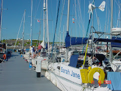
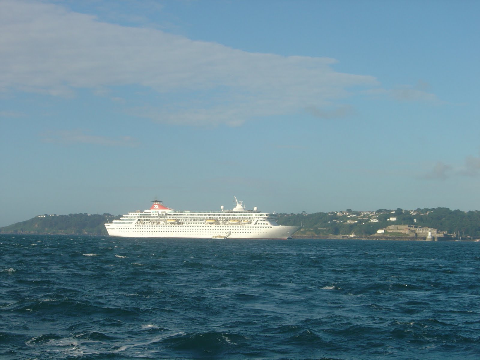